Area filtering
Let customers filter stores by province and ward directly on the public map.
On the public map, next to the search box, there are two area pickers: Province/City and Ward. Whichever area a customer picks, the map and the list narrow down to the stores inside it.
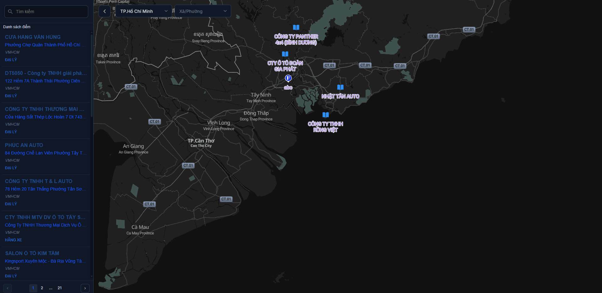
How customers use it
- Pick a Province/City — both pickers are type-to-search, so nobody has to scroll a long list.
- Pick a Ward to narrow further.
- Click the × on a picker to clear it and go back to seeing everything.
Province first, then ward
The Ward picker stays locked until a province is chosen, and only lists wards inside that province. Switching to another province clears the selected ward automatically — otherwise you would be filtering by a ward that does not belong to the new province, and the map would come back empty.
Turning the filter off in an embed
The area filter is shown by default. To remove it for a tighter embed, add &areaOptions=false to the URL in your embed code — see Embedding into a website.
Areas come from coordinates, not from the address column
The system decides which province/ward a store belongs to from its coordinates; it does not read the text of your address column. So:
- A store with wrong coordinates ends up in the wrong area, or in none at all.
- However you write the address column makes no difference to this filter.
If an area looks like it is missing stores, check the coordinates first — see Preparing your data.
This also affects area reports
The Area analysis report groups its numbers the same way. Stores that could not be matched to an administrative area are not counted in any region of that report.
Next: Publishing & sharing — make your map public for customers.