Managing structure
Add, relabel, delete and reorder the fields of a dataset.
Structure is the list of columns (fields) in a dataset. Here you can:
- Set a readable display label instead of the raw column name.
- Add new columns of various data types.
- Delete columns you no longer need.
- Reorder how columns are displayed.
Opening the field settings
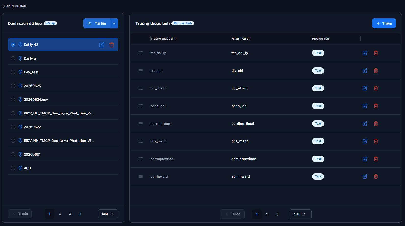
Go to Data management → Datasets and select a dataset in the left column. The right column — Fields — lists every column of that dataset with a count, each row showing: Field · Display label · Data type.
A shortcut while building a map
You do not have to leave the map to edit columns. Open the layer's data table (the Data button on the floating toolbar at the top-centre of the map) and click the Settings icon — the dialog that opens is identical to the table on the Datasets page, with the same actions.
Setting a display label
By default, column names come from the headers in your original file — often unaccented, machine-style names (ten_cua_hang, dia_chi). Giving them proper labels makes everything downstream readable.
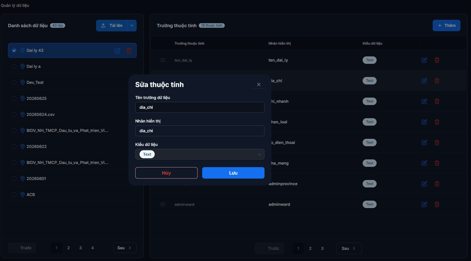
- Click the pencil icon on the row you want to change.
- Enter the Display label you want.
- Save.
Only the label is editable
In the edit dialog, Field name and Data type are shown for reference but cannot be changed — they are what your data actually relies on. To change a type you must create a new field and re-enter the data.
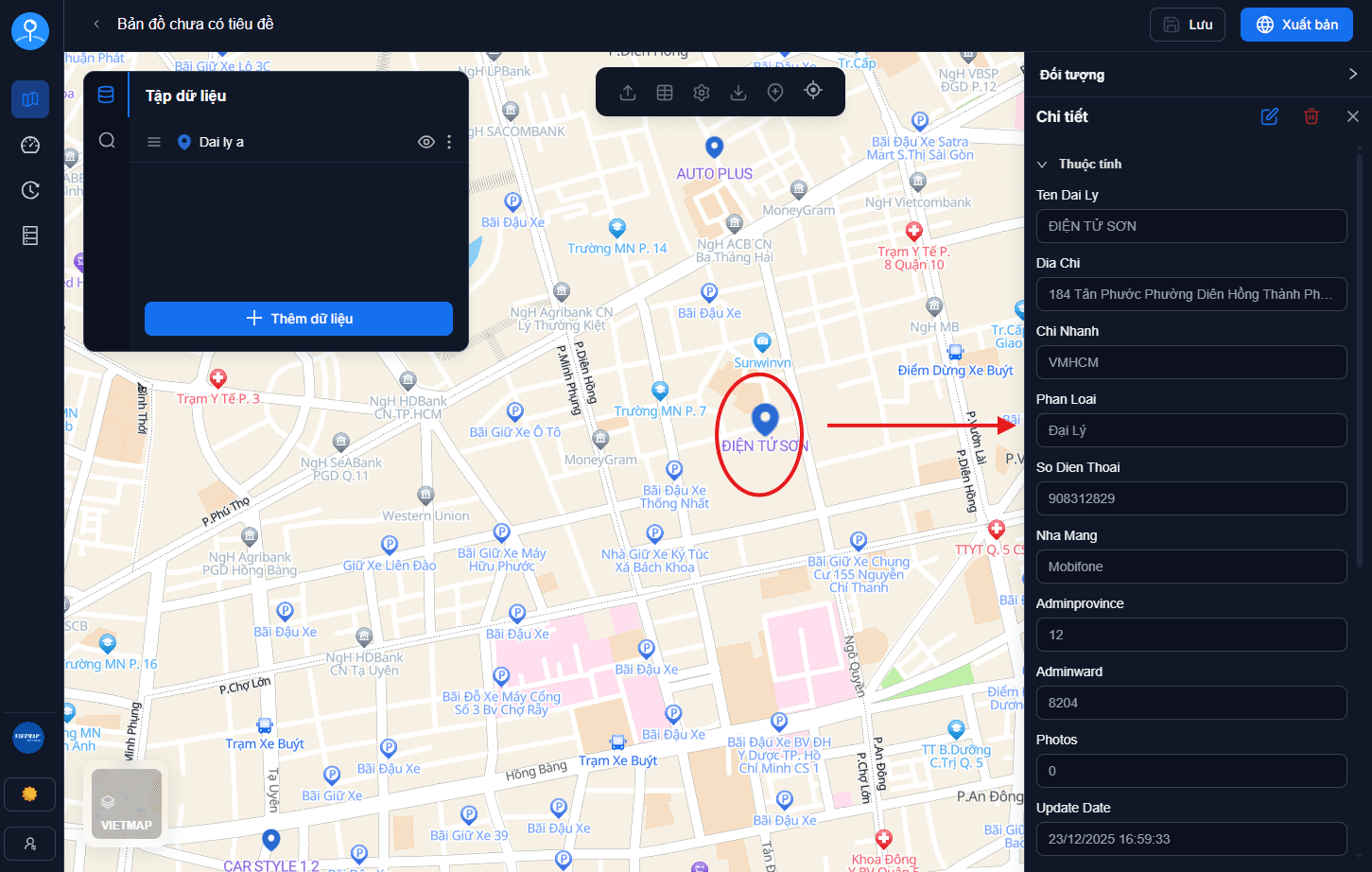
Once saved, both the data table and the detail panel on the map display the new label.
Adding a field
Click Add at the top of the Fields table, enter a field name and choose a suitable data type.
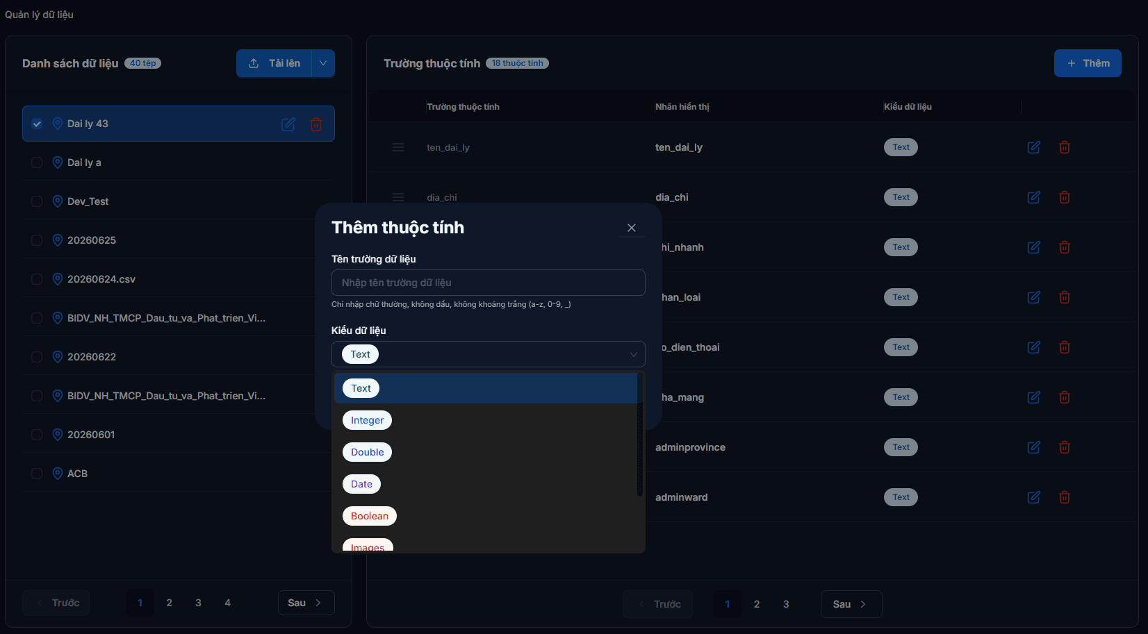
The supported types are:
| Type on screen | What it means | Use it for |
|---|---|---|
| Text | Text | Names, addresses, notes, phone numbers |
| Integer | Whole number | Quantities, ordering, numeric codes |
| Double | Number with decimals | Area, distance, revenue |
| Date | A date | Opening date, last updated |
| Boolean | True / false | Yes-no states (still trading, has parking...) |
| Images | Photos | Store photos |
| OpenHours | Opening hours | Open–close windows for each day of the week |
| Domain | A predefined list | Pick from a declared value set instead of typing freely |
Why the type names are in English
Data type names stay in English to match your original data file and the other spreadsheet / mapping tools you use (Excel, CSV, QGIS). The middle column above explains what each one means.
Category columns are better as the Domain type
If you plan to show different icons per group, the category values must match exactly — a single extra space and the icon rule stops applying. The Domain type solves this by not allowing free typing: see Domain management and Display customization.
Deleting a field
Click the trash icon on the row you want to remove, then confirm.
Some columns cannot be deleted
System fields (id, geom, province / ward codes) have no delete button — they are what keeps your stores in the right place on the map.
Deleting a column deletes all of its values
When you delete a field, its data is removed from every record and cannot be recovered.
Reordering columns
Drag and drop rows by the handle at the start of each row. The order is saved as soon as you release.
This order applies to both the data table and the detail panel shown when a customer clicks a store on the map — put the important fields (name, address, phone) first.
Next: Publishing & sharing — make your map public for customers.